
West Walls town wall and ditch
Introduction
The photograph on this page of West Walls town wall and ditch by Andrew Curtis as part of the Geograph project.
The Geograph project started in 2005 with the aim of publishing, organising and preserving representative images for every square kilometre of Great Britain, Ireland and the Isle of Man.

There are currently over 7.5m images from over 14,400 individuals and you can help contribute to the project by visiting https://www.geograph.org.uk
West Walls town wall and ditch
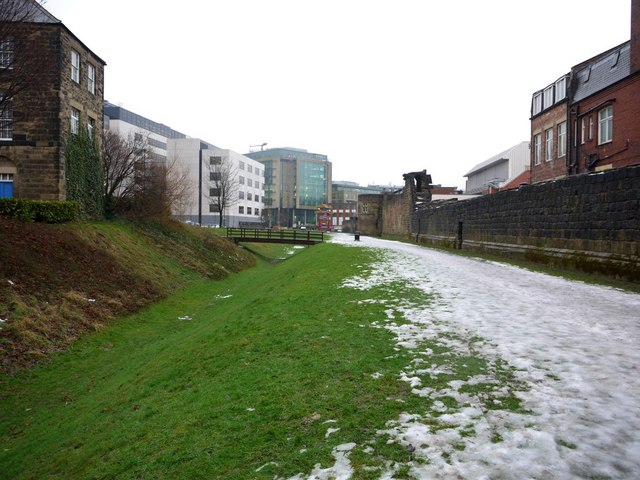
Image: © Andrew Curtis Taken: 15 Jan 2010
Shown here is the stretch of Town Wall which includes the Morden and Ever defensive Towers. The Morden Tower Image was increased in height in 1618 as a meeting place for the Plumbers, Glaziers and Pewterers Company and enlarged again in 1700. Further along are the remains of the Ever Tower Image which was occupied by the Company of Paviours, Colliers and Carriage-men, and in the 19C by an eccentric known as 'Hairy Nanny'. The deep ditch outside the walls Image was added for defensive purposes in about 1312. It was re-excavated and landscaped along this stretch in 1988. The wooden bridge replaces one in this location that was built by the Dominicans from the nearby Friary in 1312. Tyne and Wear HER (1533): Newcastle town wall, curtain north of Heber Tower http://www.twsitelines.info The building just visible on the left is the now restored isolation hospital or 'House of Recovery' built in 1804. It was closed in 1888. Tyne and Wear HER (6293): Newcastle, Bath Lane, Fever Hospital (House of Recovery): http://www.twsitelines.info St Andrew's Poor House and the Lunatic Asylum, located nearby, have been demolished. The new developments in the distance are the buildings of Citygate and Gallowgate.
Images are licensed for reuse under creativecommons.org/licenses/by-sa/2.0
Image Location

Latitude
54.972186
Longitude
-1.620993