Widden Hill House
Introduction
The photograph on this page of Widden Hill House by Derek Harper as part of the Geograph project.
The Geograph project started in 2005 with the aim of publishing, organising and preserving representative images for every square kilometre of Great Britain, Ireland and the Isle of Man.

There are currently over 7.5m images from over 14,400 individuals and you can help contribute to the project by visiting https://www.geograph.org.uk
Widden Hill House
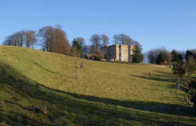
Image: © Derek Harper Taken: 3 Jan 2010
Described at http://www.heritagegateway.org.uk/Gateway/Results_Single.aspx?uid=34689&resourceID=5 as a "small country villa ... formerly a rectory", and dating from about 1815, this house is magnificently set on the crest of the Cotswold scarp above Horton Hill. Seen from the Cotswold Way which now climbs the scarp to its north.
Images are licensed for reuse under creativecommons.org/licenses/by-sa/2.0
Image Location
Latitude
51.556189
Longitude
-2.340356