Bridleway through Wheal Buller
Introduction
The photograph on this page of Bridleway through Wheal Buller by Tony Atkin as part of the Geograph project.
The Geograph project started in 2005 with the aim of publishing, organising and preserving representative images for every square kilometre of Great Britain, Ireland and the Isle of Man.

There are currently over 7.5m images from over 14,400 individuals and you can help contribute to the project by visiting https://www.geograph.org.uk
Bridleway through Wheal Buller
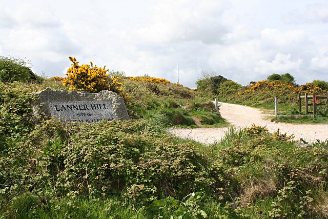
Image: © Tony Atkin Taken: 7 May 2006
This is the start of the bridleway which crosses some of the old Mine workings of Wheal Buller, one of the most productive copper mines in 19th Century Cornwall. There are unfortunately no old engine houses still standing hereabouts but the mine Count House and Captain's House were eventually saved and are now privately owned.
Images are licensed for reuse under creativecommons.org/licenses/by-sa/2.0
Image Location
Latitude
50.217303
Longitude
-5.214183