Benfield Barn
Introduction
The photograph on this page of Benfield Barn by Simon Carey as part of the Geograph project.
The Geograph project started in 2005 with the aim of publishing, organising and preserving representative images for every square kilometre of Great Britain, Ireland and the Isle of Man.

There are currently over 7.5m images from over 14,400 individuals and you can help contribute to the project by visiting https://www.geograph.org.uk
Benfield Barn
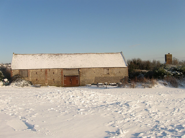
Image: © Simon Carey Taken: 7 Jan 2010
A late 18th century flint barn that is the only survivor from Benfield Manor Farm which operated from here from the late 16th century to 1871 when the farmhouse was demolished and replaced by a row of agricultural labourer's cottages. They in turn have nearly gone, the lone chimney on the right along with the concealed foundations being the only thing left of them. The barn is currently the clubhouse for the Benfield Valley Golf Course.
Images are licensed for reuse under creativecommons.org/licenses/by-sa/2.0
Image Location
Latitude
50.850002
Longitude
-0.207358