University Square (northern side). Belfast
Introduction
The photograph on this page of University Square (northern side). Belfast by Albert Bridge as part of the Geograph project.
The Geograph project started in 2005 with the aim of publishing, organising and preserving representative images for every square kilometre of Great Britain, Ireland and the Isle of Man.

There are currently over 7.5m images from over 14,400 individuals and you can help contribute to the project by visiting https://www.geograph.org.uk
University Square (northern side). Belfast
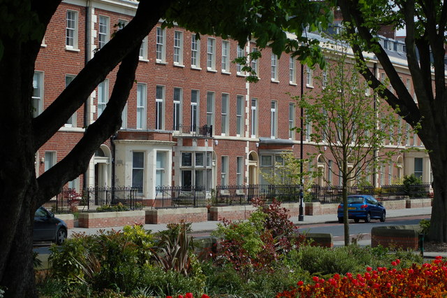
Image: © Albert Bridge Taken: 7 May 2006
As Belfast expanded during the middle of the nineteenth century its middle class sought suitable accommodation away from the linen mills and engineering works which provided the basis for their wealth. South Belfast experienced much desirable development. The area around what is now Queens University became particularly fashionable. The houses in the photograph were built between 1848 and 1853. They are now occupied by various departments of the university.
Images are licensed for reuse under creativecommons.org/licenses/by-sa/2.0
Image Location


Leaflet Map data © OpenStreetMap
Latitude
54.585627
Longitude
-5.934534