St Hilda's, Windmill Lane
Introduction
The photograph on this page of St Hilda's, Windmill Lane by David Lally as part of the Geograph project.
The Geograph project started in 2005 with the aim of publishing, organising and preserving representative images for every square kilometre of Great Britain, Ireland and the Isle of Man.

There are currently over 7.5m images from over 14,400 individuals and you can help contribute to the project by visiting https://www.geograph.org.uk
St Hilda's, Windmill Lane
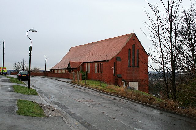
Image: © David Lally Taken: 2 Jan 2010
Now abandoned Anglican Church. The building utilised the steep hill on which it stands well. The top-floor, level with the road, was the church, while the basement floor beneath housed the vestry and church hall. I only know this because I used to attend a badminton club in the hall.
Images are licensed for reuse under creativecommons.org/licenses/by-sa/2.0
Image Location
Latitude
53.419144
Longitude
-1.444442