Dewpond on floor of Cross quarry
Introduction
The photograph on this page of Dewpond on floor of Cross quarry by Paul Harvey as part of the Geograph project.
The Geograph project started in 2005 with the aim of publishing, organising and preserving representative images for every square kilometre of Great Britain, Ireland and the Isle of Man.

There are currently over 7.5m images from over 14,400 individuals and you can help contribute to the project by visiting https://www.geograph.org.uk
Dewpond on floor of Cross quarry
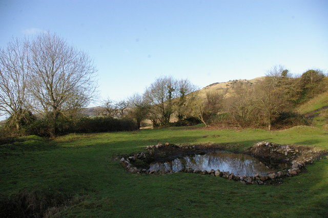
Image: © Paul Harvey Taken: 6 Dec 2009
Seriously overgrown for several years this pond was cleared by a group of National Trust Volunteers to provide a watering place for cattle, sheep and Dartmoor ponies that are used to control scrub on this western end of the Mendip Hills. Crook Peak can just be seen, in the far distance, between the two largest trees.
Images are licensed for reuse under creativecommons.org/licenses/by-sa/2.0
Image Location
Latitude
51.290379
Longitude
-2.842316