The Bush Inn, Upper Cwmbran
Introduction
The photograph on this page of The Bush Inn, Upper Cwmbran by Jaggery as part of the Geograph project.
The Geograph project started in 2005 with the aim of publishing, organising and preserving representative images for every square kilometre of Great Britain, Ireland and the Isle of Man.

There are currently over 7.5m images from over 14,400 individuals and you can help contribute to the project by visiting https://www.geograph.org.uk
The Bush Inn, Upper Cwmbran
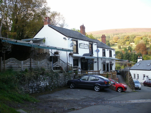
Image: © Jaggery Taken: 17 Oct 2009
Little is known about the history of the Bush Inn. One possibility is that the pub originally consisted of two cottages which were linked to form the existing premises. The Bush Inn is shown on an 1860s OS map together with the now demolished Crown. There is an inn shown on an 1830s map, but it is unclear whether this was The Bush Inn or The Crown. The Bush Inn , The Crown, The Squirrel (at the Square - now demolished) and The Queen http://www.geograph.org.uk/photo/1612705 were used by workers at the adjacent quarry, mine and brickyards, all now closed.
Images are licensed for reuse under creativecommons.org/licenses/by-sa/2.0
Image Location
Latitude
51.665269
Longitude
-3.051099