Aerial view of Kingston School and St Peter's Church, Thundersley
Introduction
The photograph on this page of Aerial view of Kingston School and St Peter's Church, Thundersley by Edward Clack as part of the Geograph project.
The Geograph project started in 2005 with the aim of publishing, organising and preserving representative images for every square kilometre of Great Britain, Ireland and the Isle of Man.

There are currently over 7.5m images from over 14,400 individuals and you can help contribute to the project by visiting https://www.geograph.org.uk
Aerial view of Kingston School and St Peter's Church, Thundersley
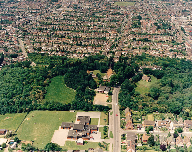
Image: © Edward Clack Taken: 6 Jun 1987
Kingston Primary School lies at the bottom centre, with Church Road to the right. The road opposite the school is Grasmere Road. The wood to the centre-left is Coombe Wood. The edge of the woodland marks the escarpment (also seen in Image). The housing beyond is New Thundersley. The Church Road can be seen continuing towards to top centre.
Images are licensed for reuse under creativecommons.org/licenses/by-sa/2.0
Image Location
Latitude
51.568721
Longitude
0.570712