Stoke Common Lane near the Salts Hole, Purton Stoke
Introduction
The photograph on this page of Stoke Common Lane near the Salts Hole, Purton Stoke by Brian Robert Marshall as part of the Geograph project.
The Geograph project started in 2005 with the aim of publishing, organising and preserving representative images for every square kilometre of Great Britain, Ireland and the Isle of Man.

There are currently over 7.5m images from over 14,400 individuals and you can help contribute to the project by visiting https://www.geograph.org.uk
Stoke Common Lane near the Salts Hole, Purton Stoke
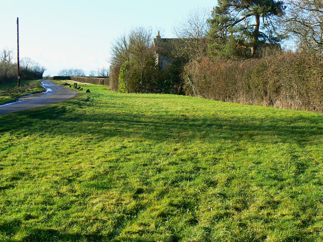
Image: © Brian Robert Marshall Taken: 27 Dec 2009
There is a wide grass verge alongside the lane (classified as a bridleway). In the days before tarmacadam was used to surface roads, lanes like this would become extremely muddy and rutted in wet weather and the line of the route would extend sideways where users might hope to find the way a little easier. Although no longer needed as a way past the mud, the verge remains. The property in the trees is The Spa and was, and perhaps still is, associated with the nearby Salts Hole http://www.geograph.org.uk/photo/1635389
Images are licensed for reuse under creativecommons.org/licenses/by-sa/2.0
Image Location
Latitude
51.614078
Longitude
-1.880659