Black Law
Introduction
The photograph on this page of Black Law by wfmillar as part of the Geograph project.
The Geograph project started in 2005 with the aim of publishing, organising and preserving representative images for every square kilometre of Great Britain, Ireland and the Isle of Man.

There are currently over 7.5m images from over 14,400 individuals and you can help contribute to the project by visiting https://www.geograph.org.uk
Black Law
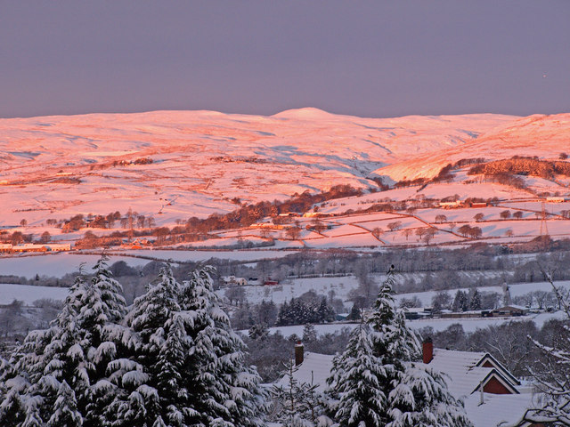
Image: © wfmillar Taken: 23 Dec 2009
View over Beith to the Kilbirnie Hills at sunrise. The highest hill is Black law and the deep valley in the hillside is cut by the Garnock River. Viewed from Roebank Road Beith.
Images are licensed for reuse under creativecommons.org/licenses/by-sa/2.0
Image Location
Latitude
55.758237
Longitude
-4.627527