The Aylesbury Arm of the Grand Union Canal
Introduction
The photograph on this page of The Aylesbury Arm of the Grand Union Canal by Cathy Cox as part of the Geograph project.
The Geograph project started in 2005 with the aim of publishing, organising and preserving representative images for every square kilometre of Great Britain, Ireland and the Isle of Man.

There are currently over 7.5m images from over 14,400 individuals and you can help contribute to the project by visiting https://www.geograph.org.uk
The Aylesbury Arm of the Grand Union Canal
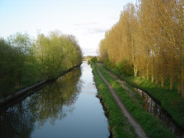
Image: © Cathy Cox Taken: 1 May 2006
This view of the Aylesbury Arm of the Grand Union Canal, which was completed in 1815, was taken from the A4157 road bridge. Bear Brook can be seen on the right hand side of the photograph running parallel with the canal. The bridge in the distance is an agricultural bridge (No 16) Beyond it is the Broughton Lane bridge, No 15. Both bridges are marked on the map and are of the standard "Aylesbury Arm" design. I am indebted to Chris Reynolds for the information about the bridges.
Images are licensed for reuse under creativecommons.org/licenses/by-sa/2.0
Image Location
Latitude
51.819283
Longitude
-0.788535