Watford: The new Wellspring Church Centre
Introduction
The photograph on this page of Watford: The new Wellspring Church Centre by Nigel Cox as part of the Geograph project.
The Geograph project started in 2005 with the aim of publishing, organising and preserving representative images for every square kilometre of Great Britain, Ireland and the Isle of Man.

There are currently over 7.5m images from over 14,400 individuals and you can help contribute to the project by visiting https://www.geograph.org.uk
Watford: The new Wellspring Church Centre
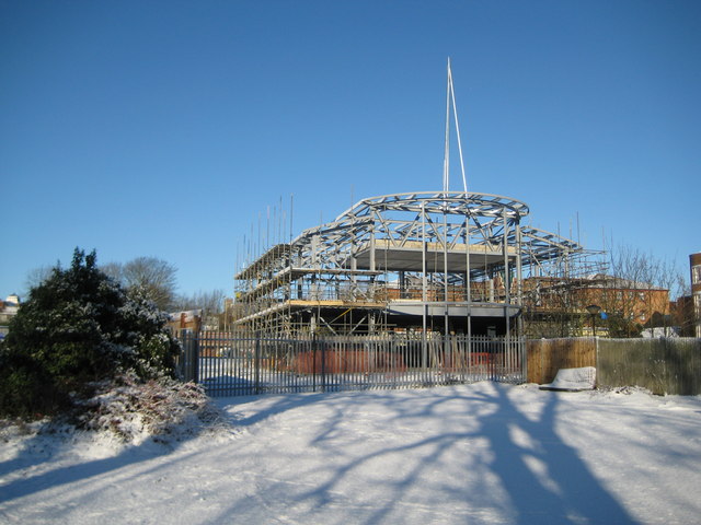
Image: © Nigel Cox Taken: 20 Dec 2009
Construction work commenced in 2009 on this new centre for the Watford Community Church, being built on the site of the ill-fated Watford Springs Leisure Swimming Pool. The building will eventually have a glass frontage, circular in plan, with an image of a cross picked out in coloured panes. The website for the church centre, showing an image of the proposed final building, is here http://www.the-wellspring.org/index.html The site had been derelict since 2001 when Watford Springs was demolished, having been closed the year previously when Watford Council decided that major faults in the building meant that it was cheaper to demolish it than repair it. Watford Springs itself was built in the 1980s(?) as a contribution to the community in return for permission to construct the Harlequin Centre Image
Images are licensed for reuse under creativecommons.org/licenses/by-sa/2.0
Image Location
Latitude
51.65168
Longitude
-0.391587