Road Closed
Introduction
The photograph on this page of Road Closed by Martin Addison as part of the Geograph project.
The Geograph project started in 2005 with the aim of publishing, organising and preserving representative images for every square kilometre of Great Britain, Ireland and the Isle of Man.

There are currently over 7.5m images from over 14,400 individuals and you can help contribute to the project by visiting https://www.geograph.org.uk
Road Closed
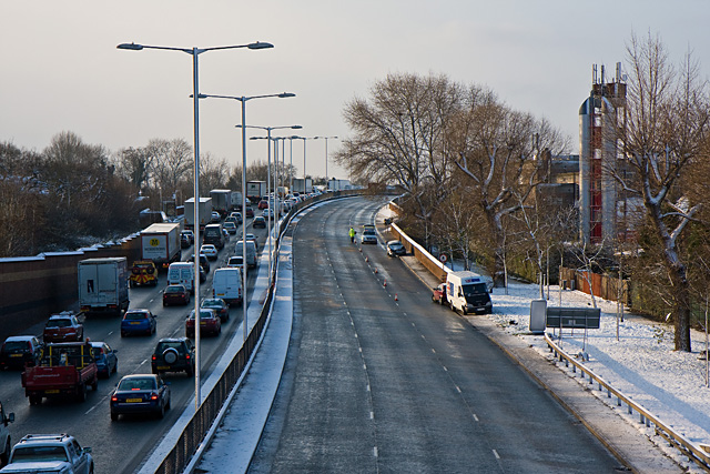
Image: © Martin Addison Taken: 18 Dec 2009
The A406 North Circular Road with the eastbound carriageway closed following an accident on the bridge over Long Lane. The vehicles involved can be seen parked on the right, along with a Police vehicle attending the scene. The road is closed between the junctions with the A1 to the A1000 - see Image Heavy traffic at Henlys Corner, compounded by the road closure, has resulted in a tailback on the westbound carriageway to this point. Finchley Fire Station is visible through the trees on the right.
Images are licensed for reuse under creativecommons.org/licenses/by-sa/2.0
Image Location
Latitude
51.598301
Longitude
-0.178481