Miners' cottages at Kemberton
Introduction
The photograph on this page of Miners' cottages at Kemberton by Richard Law as part of the Geograph project.
The Geograph project started in 2005 with the aim of publishing, organising and preserving representative images for every square kilometre of Great Britain, Ireland and the Isle of Man.

There are currently over 7.5m images from over 14,400 individuals and you can help contribute to the project by visiting https://www.geograph.org.uk
Miners' cottages at Kemberton
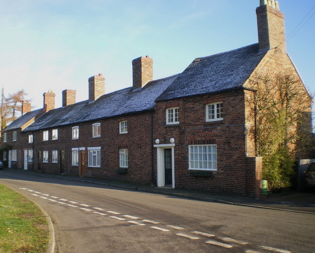
Image: © Richard Law Taken: 18 Dec 2009
These cottages show every sign of being mineworkers' homes, especially the huge chimneys which vented several fireplaces. Until about 40 years ago, there was a colliery at Kemberton, although strictly speaking, it was in the area now occupied by Halesfield Industrial Estate, roughly at SJ712055, which probably explains the existence of the public footpath leading WNW-wards from the village. This area lies towards the viable edge of the East Shropshire coalfield http://shropshiremines.org.uk/misc/shropmine/coalbrookdale_coalfield.htm The pit closed in 1967.
Images are licensed for reuse under creativecommons.org/licenses/by-sa/2.0
Image Location
Latitude
52.637478
Longitude
-2.400708