River Thames: Sunbury Weir C
Introduction
The photograph on this page of River Thames: Sunbury Weir C by Nigel Cox as part of the Geograph project.
The Geograph project started in 2005 with the aim of publishing, organising and preserving representative images for every square kilometre of Great Britain, Ireland and the Isle of Man.

There are currently over 7.5m images from over 14,400 individuals and you can help contribute to the project by visiting https://www.geograph.org.uk
River Thames: Sunbury Weir C
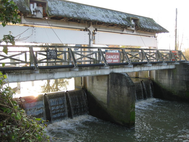
Image: © Nigel Cox Taken: 7 Dec 2008
The weir allows excess water to flow out of the main River Thames and into the back channel on the north-west side of Wheatley's Ait before rejoining the river downstream of the ait. The weir is a comparatively modern structure being built probably post-war as it is not shown on the Ordnance Survey map of 1938. It now splits the original Wheatley's Ait into separate islands. The weir has sluice boards and machinery unusually protected by a tiled pitched roof.
Images are licensed for reuse under creativecommons.org/licenses/by-sa/2.0
Image Location


Leaflet Map data © OpenStreetMap
Latitude
51.397637
Longitude
-0.417044