Bedale Street - closure for Thameslink Viaduct
Introduction
The photograph on this page of Bedale Street - closure for Thameslink Viaduct by Stephen Craven as part of the Geograph project.
The Geograph project started in 2005 with the aim of publishing, organising and preserving representative images for every square kilometre of Great Britain, Ireland and the Isle of Man.

There are currently over 7.5m images from over 14,400 individuals and you can help contribute to the project by visiting https://www.geograph.org.uk
Bedale Street - closure for Thameslink Viaduct
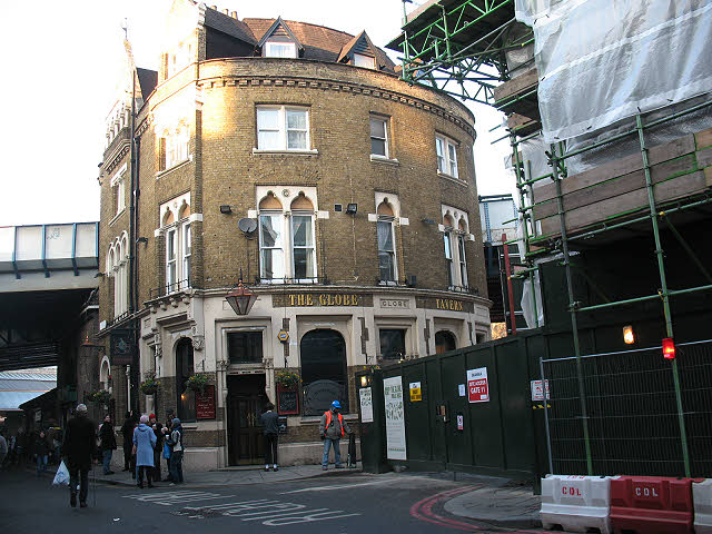
Image: © Stephen Craven Taken: 18 Dec 2009
The entrance off Bedale Street adjacent to the Globe pub was closed in late 2009 for preparations for construction of the Thameslink Viaduct. Other buildings close to the existing viaduct had already been closed ready for demolition but the pub was still open at this point.
Images are licensed for reuse under creativecommons.org/licenses/by-sa/2.0
Image Location
Latitude
51.50544
Longitude
-0.089965