By rail to Ilfracombe, 1969
Introduction
The photograph on this page of By rail to Ilfracombe, 1969 by Robin Webster as part of the Geograph project.
The Geograph project started in 2005 with the aim of publishing, organising and preserving representative images for every square kilometre of Great Britain, Ireland and the Isle of Man.

There are currently over 7.5m images from over 14,400 individuals and you can help contribute to the project by visiting https://www.geograph.org.uk
By rail to Ilfracombe, 1969
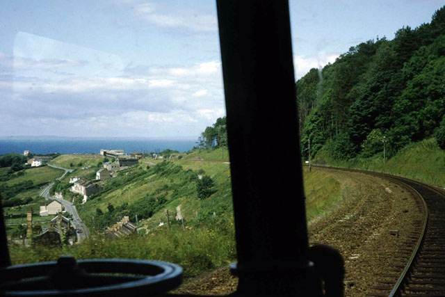
Image: © Robin Webster Taken: Unknown
The final descent into Ilfracombe , viewed through the driver's cab of a DMU, August 1969. A somewhat alarming prospect, as the station (the whitish buildings) appears to be a ski jump into the sea - what if the brakes failed? Actually the station was some way inland above the town centre.
Images are licensed for reuse under creativecommons.org/licenses/by-sa/2.0
Image Location


Leaflet Map data © OpenStreetMap
Latitude
51.193581
Longitude
-4.127725