The gap in Higham Tunnel
Introduction
The photograph on this page of The gap in Higham Tunnel by Robin Webster as part of the Geograph project.
The Geograph project started in 2005 with the aim of publishing, organising and preserving representative images for every square kilometre of Great Britain, Ireland and the Isle of Man.

There are currently over 7.5m images from over 14,400 individuals and you can help contribute to the project by visiting https://www.geograph.org.uk
The gap in Higham Tunnel
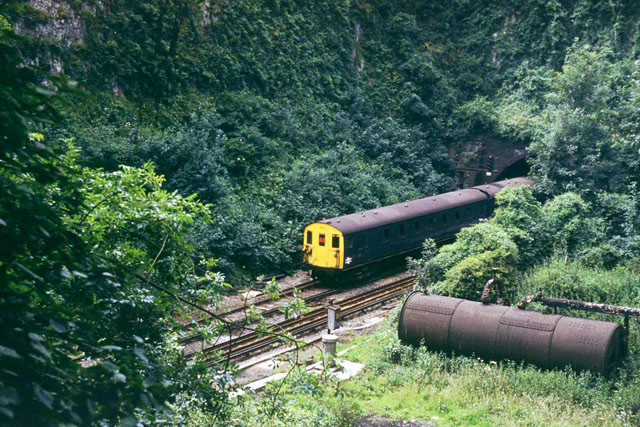
Image: © Robin Webster Taken: Unknown
The original canal tunnel was continuous,but its great length put constraints on the traffic. Accordingly, a passing place was made at a point where there was a slight declivity above, by opening out a quarry from the surface. The canal tunnel was later converted to a rather awkward dual canal and single track railway partly running on the towpath, and then to double track railway only. The old passing place remains as a densely wooded quarry. The tail end of a London-bound train is seen, in 1975.
Images are licensed for reuse under creativecommons.org/licenses/by-sa/2.0
Image Location
Latitude
51.414973
Longitude
0.481244