Knebworth: Swangley's Farm former silo
Introduction
The photograph on this page of Knebworth: Swangley's Farm former silo by Nigel Cox as part of the Geograph project.
The Geograph project started in 2005 with the aim of publishing, organising and preserving representative images for every square kilometre of Great Britain, Ireland and the Isle of Man.

There are currently over 7.5m images from over 14,400 individuals and you can help contribute to the project by visiting https://www.geograph.org.uk
Knebworth: Swangley's Farm former silo
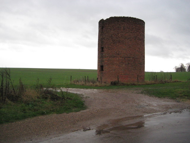
Image: © Nigel Cox Taken: 29 Nov 2009
This is an unusual early 20th century brick silo, cylindrical in plan, but now ruinous, on the opposite side of the road to the farm. Early Ordnance Survey maps available on line show that it was not present in 1899 but was in 1923.
Images are licensed for reuse under creativecommons.org/licenses/by-sa/2.0
Image Location
Latitude
51.863362
Longitude
-0.176653