Howard Street in Jarrow
Introduction
The photograph on this page of Howard Street in Jarrow by Vin Mullen as part of the Geograph project.
The Geograph project started in 2005 with the aim of publishing, organising and preserving representative images for every square kilometre of Great Britain, Ireland and the Isle of Man.

There are currently over 7.5m images from over 14,400 individuals and you can help contribute to the project by visiting https://www.geograph.org.uk
Howard Street in Jarrow
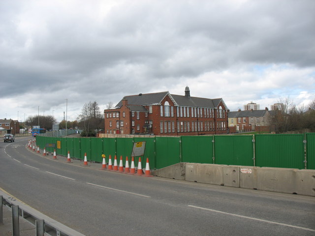
Image: © Vin Mullen Taken: 4 Apr 2009
Howard Street in Jarrow. New road construction (A185) Centre on picture is St. Bede's RC Primary School. Right off centre on the picture the terraced houses are in Harold Street. On the skyline the highrise flats are Wilkinson Court and Ellen Court.
Images are licensed for reuse under creativecommons.org/licenses/by-sa/2.0
Image Location
Latitude
54.978604
Longitude
-1.484534