Hurworth School
Introduction
The photograph on this page of Hurworth School by Gordon Hatton as part of the Geograph project.
The Geograph project started in 2005 with the aim of publishing, organising and preserving representative images for every square kilometre of Great Britain, Ireland and the Isle of Man.

There are currently over 7.5m images from over 14,400 individuals and you can help contribute to the project by visiting https://www.geograph.org.uk
Hurworth School
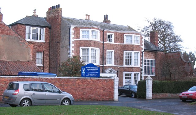
Image: © Gordon Hatton Taken: 27 Nov 2009
Private school overlooking the green and housed in a two and a half storey brick house of the 18th century. A pity about the rather ugly extensions either side. [2012 update] The school closed in 2011 and its present status is unknown.
Images are licensed for reuse under creativecommons.org/licenses/by-sa/2.0
Image Location
Latitude
54.486223
Longitude
-1.528253