Aerial view of Boyce Hill golf course and South Benfleet
Introduction
The photograph on this page of Aerial view of Boyce Hill golf course and South Benfleet by Edward Clack as part of the Geograph project.
The Geograph project started in 2005 with the aim of publishing, organising and preserving representative images for every square kilometre of Great Britain, Ireland and the Isle of Man.

There are currently over 7.5m images from over 14,400 individuals and you can help contribute to the project by visiting https://www.geograph.org.uk
Aerial view of Boyce Hill golf course and South Benfleet
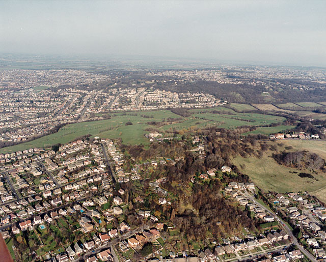
Image: © Edward Clack Taken: 29 Mar 1990
Boyce Hill golf course is the green swathe across the centre of the photo, occupying the centre of South Benfleet. The woodland above it is Thundersley Glen (also seen in Image). The sloping ground to the lower right borders onto Essex Way. We used to live in the small road at the bottom right, Norwood Drive, and the first winter after we moved there, this hillside was snow covered and used by skiers and tobogganers.
Images are licensed for reuse under creativecommons.org/licenses/by-sa/2.0
Image Location
Latitude
51.555922
Longitude
0.572009