
Grange Road in Jarrow
Introduction
The photograph on this page of Grange Road in Jarrow by Vin Mullen as part of the Geograph project.
The Geograph project started in 2005 with the aim of publishing, organising and preserving representative images for every square kilometre of Great Britain, Ireland and the Isle of Man.

There are currently over 7.5m images from over 14,400 individuals and you can help contribute to the project by visiting https://www.geograph.org.uk
Grange Road in Jarrow
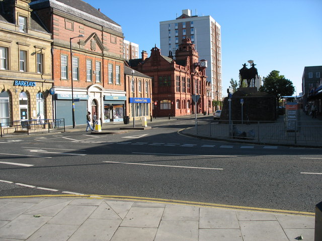
Image: © Vin Mullen Taken: 7 Sep 2006
Grange Road at the junction of Ellison Street in Jarrow looking East To the left on the picture, Barclays Bank Next the Masonic Hall (what a beautiful building for its society of members who live together for their mutual benefit. Something to be proud of. May I be so bold as to ask, where are our other societies such as the Co-operative Society, The Union Society, The Labour Society etc...) Then the Town Hall Wilkinson Court (Highrise flats) behind that To the right of the picture the Viking Statues And the far left the Viking Centre
Images are licensed for reuse under creativecommons.org/licenses/by-sa/2.0
Image Location

Latitude
54.981323
Longitude
-1.489968