Looking down Stanley Road, Newport
Introduction
The photograph on this page of Looking down Stanley Road, Newport by Jaggery as part of the Geograph project.
The Geograph project started in 2005 with the aim of publishing, organising and preserving representative images for every square kilometre of Great Britain, Ireland and the Isle of Man.

There are currently over 7.5m images from over 14,400 individuals and you can help contribute to the project by visiting https://www.geograph.org.uk
Looking down Stanley Road, Newport
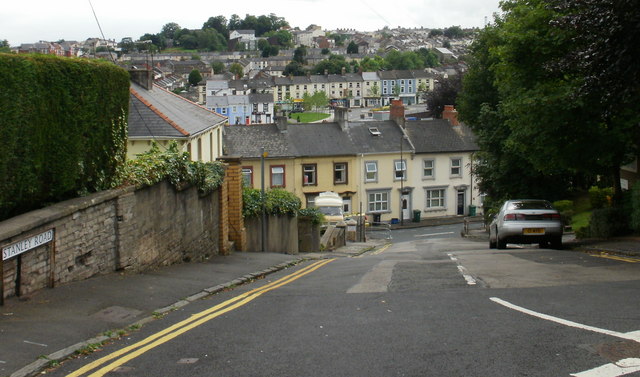
Image: © Jaggery Taken: 16 Aug 2009
Stanley Road is a candidate for the steepest road in Newport. It rises from 17.6 metres at its base in Devon Place to 28.8 metres at its junction with Gold Tops. The horizontal distance covered (as shown on a map ) is 59 metres, which gives a gradient of 1 in 5.3 As can be seen here, it joins Devon Place at a T junction, so in my younger, cycling, days it was one of the 'impossible' gradients, as a 'flying start' is not possible. It was not a hill to cycle down either, except with brakes engaged. Fortunately, Stanley Road is not an essential link in the Newport road network. A short detour via Pentonville avoids the excessive steepness. The view from the bottom http://www.geograph.org.uk/photo/1596720
Images are licensed for reuse under creativecommons.org/licenses/by-sa/2.0
Image Location
Latitude
51.589272
Longitude
-3.001709