Elvet Bridge
Introduction
The photograph on this page of Elvet Bridge by David Newton as part of the Geograph project.
The Geograph project started in 2005 with the aim of publishing, organising and preserving representative images for every square kilometre of Great Britain, Ireland and the Isle of Man.

There are currently over 7.5m images from over 14,400 individuals and you can help contribute to the project by visiting https://www.geograph.org.uk
Elvet Bridge
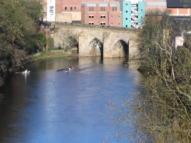
Image: © David Newton Taken: 7 Nov 2009
Looking north along the River Wear from Kingsbridge towards Elvet Bridge. The Grade 1 listed, 10 arched, Elvet Bridge was originally built in 1160 but has undergone extensive repairs since, at the end of the 15th.C and the beginning of the 17th.C. It again, in 1771, needed repair after flood damage.
Images are licensed for reuse under creativecommons.org/licenses/by-sa/2.0
Image Location
Latitude
54.775495
Longitude
-1.573397