The Globe Inn, Rastrick Common, Rastrick
Introduction
The photograph on this page of The Globe Inn, Rastrick Common, Rastrick by Humphrey Bolton as part of the Geograph project.
The Geograph project started in 2005 with the aim of publishing, organising and preserving representative images for every square kilometre of Great Britain, Ireland and the Isle of Man.

There are currently over 7.5m images from over 14,400 individuals and you can help contribute to the project by visiting https://www.geograph.org.uk
The Globe Inn, Rastrick Common, Rastrick
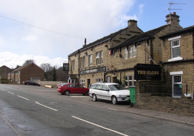
Image: © Humphrey Bolton Taken: 8 Apr 2006
Rastrick Common was a main road from the year dot until the mid-20C, when it became unclassified. It could be on the line of a Roman road, and was part of the medieval main road from Wakefield to Elland, which was turnpiked in 1759. In 1806 it became the continuation of the New Hey Road over to Lancashire. The Globe Inn is one of two coaching inns along Rastrick Common.
Images are licensed for reuse under creativecommons.org/licenses/by-sa/2.0
Image Location
Latitude
53.693355
Longitude
-1.78643