Morlands Site Glastonbury (13)
Introduction
The photograph on this page of Morlands Site Glastonbury (13) by Nigel Mykura as part of the Geograph project.
The Geograph project started in 2005 with the aim of publishing, organising and preserving representative images for every square kilometre of Great Britain, Ireland and the Isle of Man.

There are currently over 7.5m images from over 14,400 individuals and you can help contribute to the project by visiting https://www.geograph.org.uk
Morlands Site Glastonbury (13)
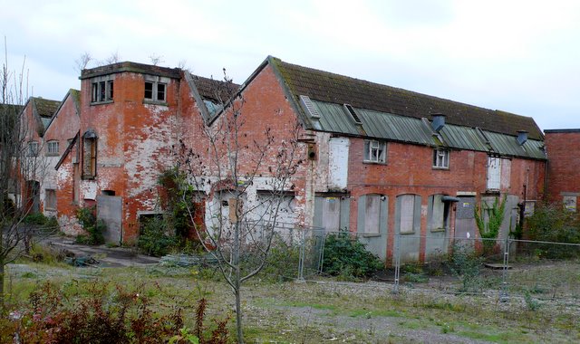
Image: © Nigel Mykura Taken: 11 Nov 2009
These are the most southerly buildings that remain on the siteclose to the junction of the southern end of Beckery Old Rd and the Street Rd. This view is due west along the grid line between ST4838 and ST4837. The buildings in the right hand two thirds of the image are in ST4838, those on the left are in ST4837.
Images are licensed for reuse under creativecommons.org/licenses/by-sa/2.0
Image Location
Latitude
51.138949
Longitude
-2.736212