Track bed of closed Walsall - Wolverhampton line at Willenhall
Introduction
The photograph on this page of Track bed of closed Walsall - Wolverhampton line at Willenhall by Tim Marshall as part of the Geograph project.
The Geograph project started in 2005 with the aim of publishing, organising and preserving representative images for every square kilometre of Great Britain, Ireland and the Isle of Man.

There are currently over 7.5m images from over 14,400 individuals and you can help contribute to the project by visiting https://www.geograph.org.uk
Track bed of closed Walsall - Wolverhampton line at Willenhall
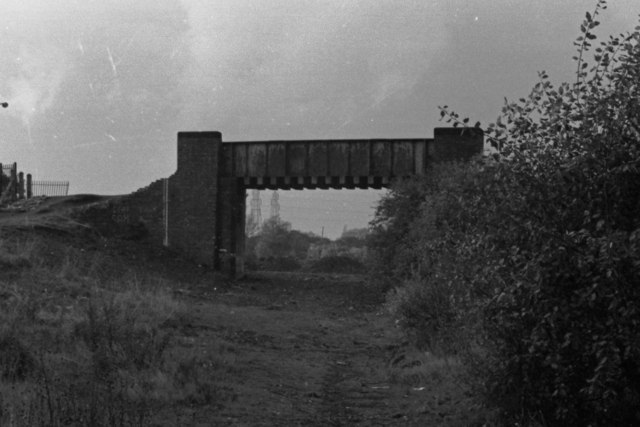
Image: © Tim Marshall Taken: 17 Oct 1978
Track bed of closed Walsall - Wolverhampton line just short of the "Iron Bridge", looking towards Noose Lane and Wednesfield, 1978. Willenhall Park is to the left. This bridge is still in situ and has received a coat of paint in recent times!
Images are licensed for reuse under creativecommons.org/licenses/by-sa/2.0
Image Location
Latitude
52.589325
Longitude
-2.06269