Sign for Stranford Lough Cycle Trail at Killyleagh
Introduction
The photograph on this page of Sign for Stranford Lough Cycle Trail at Killyleagh by David Hawgood as part of the Geograph project.
The Geograph project started in 2005 with the aim of publishing, organising and preserving representative images for every square kilometre of Great Britain, Ireland and the Isle of Man.

There are currently over 7.5m images from over 14,400 individuals and you can help contribute to the project by visiting https://www.geograph.org.uk
Sign for Stranford Lough Cycle Trail at Killyleagh
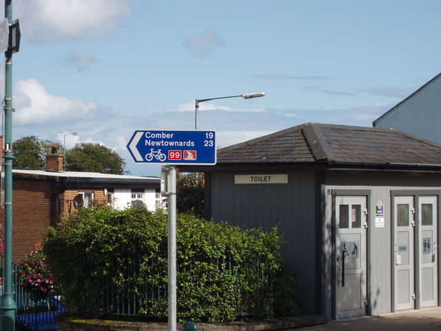
Image: © David Hawgood Taken: 4 Sep 2009
The sign is for National Cycle Network route 99, showing 19 miles to Comber and 23 to Newtownards. The trail goes around Stranford Lough, with a connection to Belfast.
Images are licensed for reuse under creativecommons.org/licenses/by-sa/2.0
Image Location
Latitude
54.401671
Longitude
-5.652708