Penwortham Priory Lodge
Introduction
The photograph on this page of Penwortham Priory Lodge by Margaret Clough as part of the Geograph project.
The Geograph project started in 2005 with the aim of publishing, organising and preserving representative images for every square kilometre of Great Britain, Ireland and the Isle of Man.

There are currently over 7.5m images from over 14,400 individuals and you can help contribute to the project by visiting https://www.geograph.org.uk
Penwortham Priory Lodge
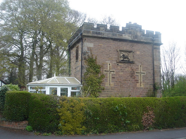
Image: © Margaret Clough Taken: 24 Apr 2006
This was originally the Penwortham Priory Lodge, which stood on Penwortham Hill at the junction with Church Avenue (which is now little more than a track at that point). It was demolished in 1912 for the widening of Penwortham Hill and rebuilt in its present position. You can see photographs of it on its original site at: http://ibase.lancashire.gov.uk/index.php?a=showall&s=item&key=AYTozOntpOjA7czoxOiIxIjtpOjE7czoxOiI2IjtpOjI7czoxOiI3Ijt9&pg=328 and: http://ibase.lancashire.gov.uk/index.php?a=showall&s=item&key=AYTozOntpOjA7czoxOiIxIjtpOjE7czoxOiI2IjtpOjI7czoxOiI3Ijt9&pg=330
Images are licensed for reuse under creativecommons.org/licenses/by-sa/2.0
Image Location
Latitude
53.732473
Longitude
-2.760909