Churchdown - the old pub
Introduction
The photograph on this page of Churchdown - the old pub by Tony Bailey as part of the Geograph project.
The Geograph project started in 2005 with the aim of publishing, organising and preserving representative images for every square kilometre of Great Britain, Ireland and the Isle of Man.

There are currently over 7.5m images from over 14,400 individuals and you can help contribute to the project by visiting https://www.geograph.org.uk
Churchdown - the old pub
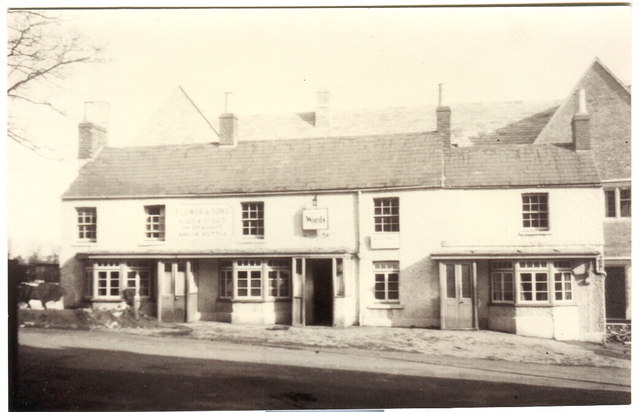
Image: © Tony Bailey Taken: Unknown
This was the old pub in the centre of Churchdown. If you look carefully you can see the 'new' pub - the Bat and Ball Inn - being constructed in the background. The date is late '40s. See recent photo of The Bat and Ball Inn. http://www.geograph.org.uk/photo/157678
Images are licensed for reuse under creativecommons.org/licenses/by-sa/2.0
Image Location
Latitude
51.875748
Longitude
-2.168454