Aerial view of plotland south of London Road, Benfleet
Introduction
The photograph on this page of Aerial view of plotland south of London Road, Benfleet by Edward Clack as part of the Geograph project.
The Geograph project started in 2005 with the aim of publishing, organising and preserving representative images for every square kilometre of Great Britain, Ireland and the Isle of Man.

There are currently over 7.5m images from over 14,400 individuals and you can help contribute to the project by visiting https://www.geograph.org.uk
Aerial view of plotland south of London Road, Benfleet
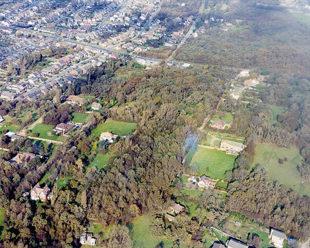
Image: © Edward Clack Taken: 16 Oct 1987
Most of Benfleet's plotlands are well to the north of here. There is, however, a patch of plotland in central Benfleet. Like that further north, much of the open land here is used for horse grazing. The road running across the upper half is the A13 (London Road). The road running to the top from the centre of this is Rhoda Road North. Like many roads in this area, part of this is unmade. The woodland at the upper right is Coombe Wood. Part of this is secondary, but much has the characteristics of ancient woodland. The London Road alongside the wood begins a rise upwards from the London Clay flatlands to the left up to the Claygate and Bagshot Beds to the right of the photo. This stretch is known as the Bread and Cheese Hill (see Image, here Coombe Wood is on the right).
Images are licensed for reuse under creativecommons.org/licenses/by-sa/2.0
Image Location
Latitude
51.561663
Longitude
0.568582