Aerial view of King John School, Benfleet, wide view
Introduction
The photograph on this page of Aerial view of King John School, Benfleet, wide view by Edward Clack as part of the Geograph project.
The Geograph project started in 2005 with the aim of publishing, organising and preserving representative images for every square kilometre of Great Britain, Ireland and the Isle of Man.

There are currently over 7.5m images from over 14,400 individuals and you can help contribute to the project by visiting https://www.geograph.org.uk
Aerial view of King John School, Benfleet, wide view
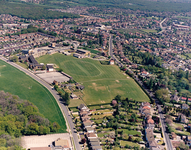
Image: © Edward Clack Taken: 8 May 1987
King John school is one of three large comprehensive schools in Benfleet. It lies between Shipwright's Drive (running across the lower left) and Benfleet Road (running right of centre). At the bottom left, the building partly visible is the Holywood Restaurant. The wood at the top left is West Wood, and that at the top right is Belfairs Wood.
Images are licensed for reuse under creativecommons.org/licenses/by-sa/2.0
Image Location
Latitude
51.556229
Longitude
0.594822