Hullen Edge Gatepost
Introduction
The photograph on this page of Hullen Edge Gatepost by David Rogers as part of the Geograph project.
The Geograph project started in 2005 with the aim of publishing, organising and preserving representative images for every square kilometre of Great Britain, Ireland and the Isle of Man.

There are currently over 7.5m images from over 14,400 individuals and you can help contribute to the project by visiting https://www.geograph.org.uk
Hullen Edge Gatepost
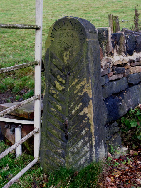
Image: © David Rogers Taken: 6 Nov 2009
Beside Broad Carr Lane and inscribed Hullen Edge, 1854, AH. Hullen Edge farmhouse, which dates from 1677, is over 4.6kms away.
Images are licensed for reuse under creativecommons.org/licenses/by-sa/2.0
Image Location
Latitude
53.674589
Longitude
-1.860698