Oakwood Farm
Introduction
The photograph on this page of Oakwood Farm by Simon Carey as part of the Geograph project.
The Geograph project started in 2005 with the aim of publishing, organising and preserving representative images for every square kilometre of Great Britain, Ireland and the Isle of Man.

There are currently over 7.5m images from over 14,400 individuals and you can help contribute to the project by visiting https://www.geograph.org.uk
Oakwood Farm
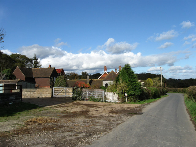
Image: © Simon Carey Taken: 4 Nov 2009
The farmhouse is the red tiled building to the rear, the grey weatherboarded house being Blabers Mead named after a nearby field. Oakwood stables are out of shot to the left whilst Streat Lane is the road on the right.
Images are licensed for reuse under creativecommons.org/licenses/by-sa/2.0
Image Location
Latitude
50.90878
Longitude
-0.080495