Ardintigh from Loch Nevis
Introduction
The photograph on this page of Ardintigh from Loch Nevis by Anthony O'Neil as part of the Geograph project.
The Geograph project started in 2005 with the aim of publishing, organising and preserving representative images for every square kilometre of Great Britain, Ireland and the Isle of Man.

There are currently over 7.5m images from over 14,400 individuals and you can help contribute to the project by visiting https://www.geograph.org.uk
Ardintigh from Loch Nevis
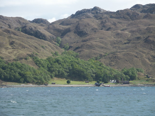
Image: © Anthony O'Neil Taken: 30 May 2006
The very rugged nature of the terrain above Ardintigh can be seen clearly here. This is characteristic of the whole of the area around Morar, and helps to explain why so few roads penetrate the interior, and why travel is so much easier by boat. This shot was taken from the ferry which plies daily between Mallaig and the communities of Loch Nevis, bringing supplies, passengers and mail.
Images are licensed for reuse under creativecommons.org/licenses/by-sa/2.0
Image Location
Latitude
56.976305
Longitude
-5.658933