Castle Cottages and Mead Cottage
Introduction
The photograph on this page of Castle Cottages and Mead Cottage by Ian Capper as part of the Geograph project.
The Geograph project started in 2005 with the aim of publishing, organising and preserving representative images for every square kilometre of Great Britain, Ireland and the Isle of Man.

There are currently over 7.5m images from over 14,400 individuals and you can help contribute to the project by visiting https://www.geograph.org.uk
Castle Cottages and Mead Cottage
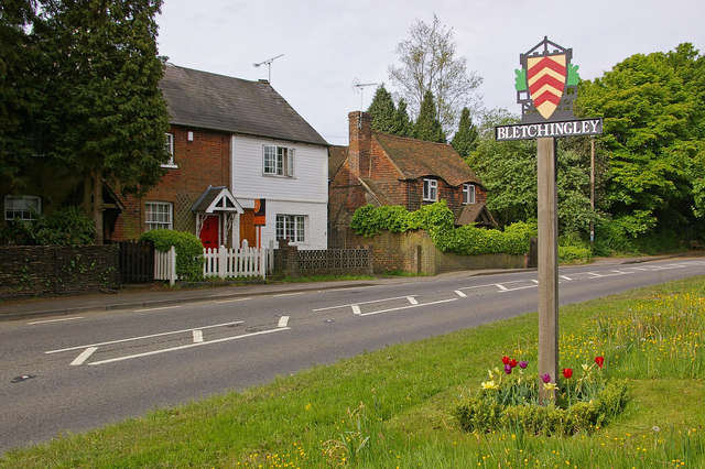
Image: © Ian Capper Taken: 9 May 2009
Castle Cottages are Victorian. Mead Cottage (on the right) is late 17th century. The village sign, unveiled in June 2008 and designed by the Rector of Bletchingley, the Revd Peter Moseling, shows the arms of the de Clare family (who owned the area following the Norman Conquest), surrounded by symbols representing the castle (now just earthworks), the church, timbered houses and woodland.
Images are licensed for reuse under creativecommons.org/licenses/by-sa/2.0
Image Location
Latitude
51.240238
Longitude
-0.105627