Blocked gateway, Old Bank, Halifax
Introduction
The photograph on this page of Blocked gateway, Old Bank, Halifax by Humphrey Bolton as part of the Geograph project.
The Geograph project started in 2005 with the aim of publishing, organising and preserving representative images for every square kilometre of Great Britain, Ireland and the Isle of Man.

There are currently over 7.5m images from over 14,400 individuals and you can help contribute to the project by visiting https://www.geograph.org.uk
Blocked gateway, Old Bank, Halifax
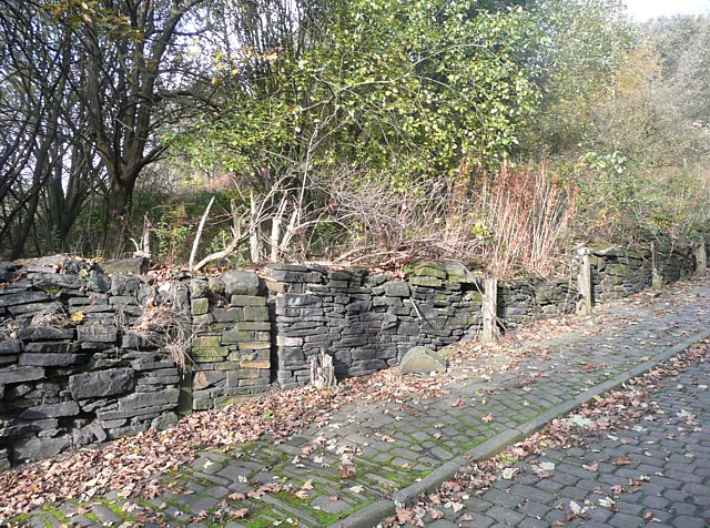
Image: © Humphrey Bolton Taken: 29 Oct 2009
None of the many cottages that are shown alongside Old Bank on old maps have survived, and the only evidence of them is this blocked gateway for a building on the north side at the foot of the hill. To the right are the broken remains of the first of a series of reinforced concrete posts of unknown purpose.
Images are licensed for reuse under creativecommons.org/licenses/by-sa/2.0
Image Location


Leaflet Map data © OpenStreetMap
Latitude
53.724012
Longitude
-1.851442