The Kipperoch Road at Succoth
Introduction
The photograph on this page of The Kipperoch Road at Succoth by Lairich Rig as part of the Geograph project.
The Geograph project started in 2005 with the aim of publishing, organising and preserving representative images for every square kilometre of Great Britain, Ireland and the Isle of Man.

There are currently over 7.5m images from over 14,400 individuals and you can help contribute to the project by visiting https://www.geograph.org.uk
The Kipperoch Road at Succoth
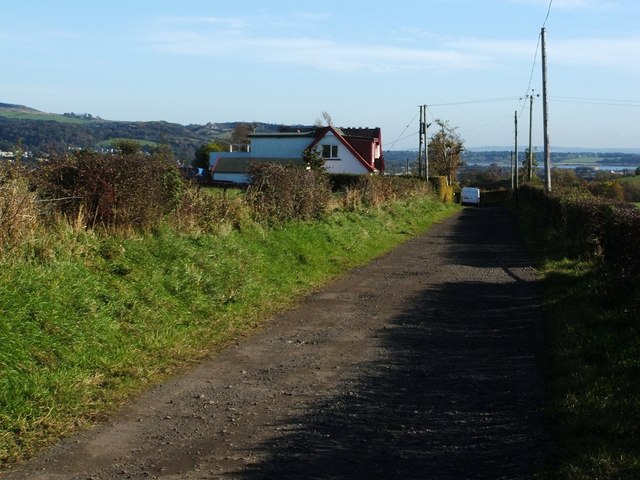
Image: © Lairich Rig Taken: 16 Oct 2009
Beside the road is a short row of houses. The nearest is called Succoth Lodge; for a closer view, see Image In about 2010, not long after the present picture was taken, another house was built on the near side of it, as shown in Image (taken in 2018). (The tower that used to stand near here is discussed below.) The names of most of these houses are, like the houses themselves, quite modern, but the name "Succoth" has been associated with this area for a very long time. A map of the region ("Levinia"), as surveyed by Timothy Pont in the 1580s and 1590s, but published by Joan Blaeu in 1654, shows it as "Sococh"; this is much closer to the original form of the name, which is evidently the Gaelic "Socach". Likewise, Dumbarton's Burgh Records, in their entry for August 14th 1627, mention "R[ober]t Campbell of Sokkoch", probably referring to this location. The word "socach" is defined by Dwelly's "Illustrated Gaelic English Dictionary" as a "certain extent of arable land" (evidently the most common meaning), and as "soccage, tenure of lands by service fixed and determined in quality". The definition ends with the comment "as a place-name Succoth in English". (For a similar example, see Image, where the corresponding Gaelic name Socach is shown on the OS map.) [There are several examples of the place-name "Succoth" in Scotland; some of these I have seen explained as meaning, literally, "beak" or "snout" (from the Gaelic "soc"), and so, by extension, the pointed area of land enclosed by two streams above their point of confluence. Whether that proposed explanation is correct, and whether it applies in the present case, I cannot say.] Why does "Socach" regularly become "Succoth" in English? I'm speculating that this is from the influence of the Biblical place-name Succoth (Hebrew סֻכּוֹת = "booths", "temporary dwellings"); this name occurs about 20 times in the Bible, and would therefore, in centuries past, have been quite familiar. - - • - - The old farm-house of Succoth stood at about Image; it is marked on the first-edition OS map (based on surveys made in 1860) and on the second-edition map (based on revisions made in 1896). By the time of the next revision of the map (1914), that building had gone. Its stones, though, were not wasted, but were used to build a tower that stood alone in the field, near the former site of the farm-house, for several decades; see Image for that general area. That tower, which was therefore of no antiquity, is probably to be identified with a small square structure that is marked at about Image on the 1914 and 1937 revisions of the map. Visitors could, after seeking the farmer's permission, enjoy a very fine view from the top.
Images are licensed for reuse under creativecommons.org/licenses/by-sa/2.0
Image Location
Latitude
55.958931
Longitude
-4.598657