Former route of the coastal path, south of Belle Vue Road
Introduction
The photograph on this page of Former route of the coastal path, south of Belle Vue Road by Jim Champion as part of the Geograph project.
The Geograph project started in 2005 with the aim of publishing, organising and preserving representative images for every square kilometre of Great Britain, Ireland and the Isle of Man.

There are currently over 7.5m images from over 14,400 individuals and you can help contribute to the project by visiting https://www.geograph.org.uk
Former route of the coastal path, south of Belle Vue Road
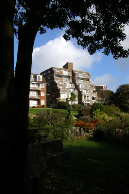
Image: © Jim Champion Taken: 25 Oct 2009
A beautiful view from these flats, maybe, but not a such beauty to look at. There is an identical block hidden behind the block seen here. The coast path used to continue on from here to the right, around the bottom of the gardens, but a mudslide in April 2001 wiped it out and now this is a 'dead-end' path at the northern extreme of Durlston Country Park. There is stone seat in the shadows beneath the tree in the foreground, but its inscription is badly weathered and thus hard to read. The far section of the former coastal path climbs up between the ugly flats and the block beyond, via a set of stone steps. These can still be accessed from Belle Vue Road, but now they only lead to the top of the Zigzag Path which leads down to the bottom of the cliffs in the middle of Durlston Bay.
Images are licensed for reuse under creativecommons.org/licenses/by-sa/2.0
Image Location
Latitude
50.602431
Longitude
-1.953458