Thundersley Manor House and the Shops
Introduction
The photograph on this page of Thundersley Manor House and the Shops by Edward Clack as part of the Geograph project.
The Geograph project started in 2005 with the aim of publishing, organising and preserving representative images for every square kilometre of Great Britain, Ireland and the Isle of Man.

There are currently over 7.5m images from over 14,400 individuals and you can help contribute to the project by visiting https://www.geograph.org.uk
Thundersley Manor House and the Shops
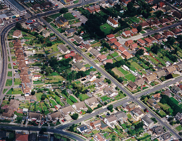
Image: © Edward Clack Taken: 10 Jul 1988
Thundersley Manor is the large white house to the top centre. The road from top left to bottom right is Manor Road, with the Manor Road shops just visible to the top left. The road curving from the top round to the left is the Church Road (always with a 'the' by the locals). It extends from St Peter's Church well to the east, almost to St George's church to the west.
Images are licensed for reuse under creativecommons.org/licenses/by-sa/2.0
Image Location
Latitude
51.570912
Longitude
0.561022