Waterfall near Gilwern
Introduction
The photograph on this page of Waterfall near Gilwern by RAY JONES as part of the Geograph project.
The Geograph project started in 2005 with the aim of publishing, organising and preserving representative images for every square kilometre of Great Britain, Ireland and the Isle of Man.

There are currently over 7.5m images from over 14,400 individuals and you can help contribute to the project by visiting https://www.geograph.org.uk
Waterfall near Gilwern
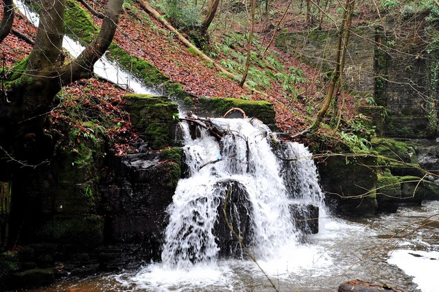
Image: © RAY JONES Taken: 14 Jan 2009
This waterfall is man-made. It is formed by the overflow from the Monmouthshire and Brecon Canal. The outfall is flowing into the River Clydach. If you look carefully you can just see the abutment of the aqueduct that carries the Canal over the river. The waterfall can be reached via a precarious walk up the River Clydach embankment.
Images are licensed for reuse under creativecommons.org/licenses/by-sa/2.0
Image Location
Latitude
51.824171
Longitude
-3.097744