Former chapel, Welton
Introduction
The photograph on this page of Former chapel, Welton by Derek Harper as part of the Geograph project.
The Geograph project started in 2005 with the aim of publishing, organising and preserving representative images for every square kilometre of Great Britain, Ireland and the Isle of Man.

There are currently over 7.5m images from over 14,400 individuals and you can help contribute to the project by visiting https://www.geograph.org.uk
Former chapel, Welton
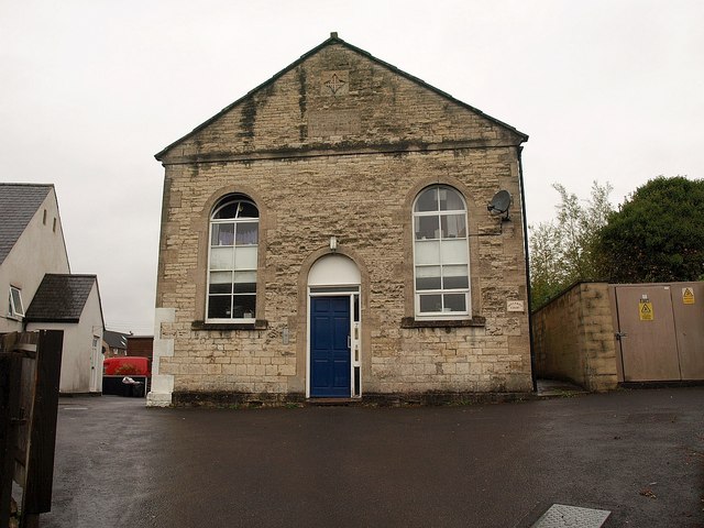
Image: © Derek Harper Taken: 7 Oct 2009
There are two former chapels on this site; to the left is a modern extension at the rear of a neo-gothic baptist chapel facing West Road, which is listed https://historicengland.org.uk/listing/the-list/list-entry/1115225 , with the date given unequivocally as 1839. This neo-classical facade, which also has a quatrefoil, faces Millard's Hill and has a tablet inscribed "Primitive Methodist Chapel AD 1858", is not listed. (Both have been converted into flats, known as Millard's Court.) https://docplayer.net/85018444-Midsomer-norton-and-welton-conservation-area-character-appraisal.html describes this as "built of squared coursed white lias limestone rubble with oolitic limestone dressings and semi-circular headed windows and central door". But it gives a date of 1935 for the listed building next door. I think, however, that must be the date of the extension.
Images are licensed for reuse under creativecommons.org/licenses/by-sa/2.0
Image Location
Latitude
51.293425
Longitude
-2.477377