Stowe: The Oxford Bridge and Water
Introduction
The photograph on this page of Stowe: The Oxford Bridge and Water by Nigel Cox as part of the Geograph project.
The Geograph project started in 2005 with the aim of publishing, organising and preserving representative images for every square kilometre of Great Britain, Ireland and the Isle of Man.

There are currently over 7.5m images from over 14,400 individuals and you can help contribute to the project by visiting https://www.geograph.org.uk
Stowe: The Oxford Bridge and Water
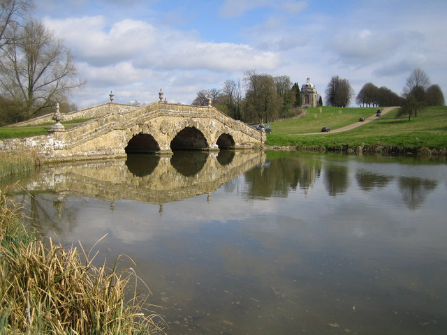
Image: © Nigel Cox Taken: 16 Apr 2006
Oxford Water is an artificial serpentine lake created by the damming of the original small stream from the village of Dadford. The Bridge was built in 1761 to carry the main approach track to Stowe from the Oxford direction. The Boycott Pavilion in Image is visible to the left of the track on the brow of the hill.
Images are licensed for reuse under creativecommons.org/licenses/by-sa/2.0
Image Location
Latitude
52.025614
Longitude
-1.029287