Clarbeston Road railway station photo survey (10)
Introduction
The photograph on this page of Clarbeston Road railway station photo survey (10) by Andy F as part of the Geograph project.
The Geograph project started in 2005 with the aim of publishing, organising and preserving representative images for every square kilometre of Great Britain, Ireland and the Isle of Man.

There are currently over 7.5m images from over 14,400 individuals and you can help contribute to the project by visiting https://www.geograph.org.uk
Clarbeston Road railway station photo survey (10)
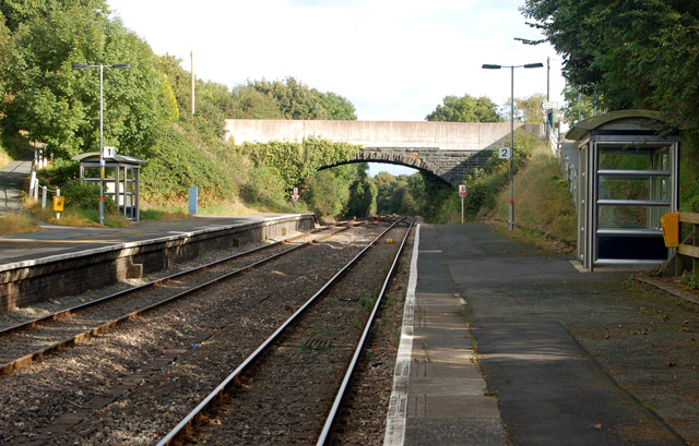
Image: © Andy F Taken: 22 Sep 2009
Looking in the up (east) direction along the platforms at Clarbeston Road station. Access to both platforms is by ramps from the road bridge - the ramp to the up platform (left of photo) can be seen behind the waiting shelter. Clarbeston Road railway station is on the West Wales line from Swansea to Pembrokeshire. Immediately west of the station, the line divides at Clarbeston Road Junction, one branch serving the ferry terminal at Fishguard, the other serving Haverfordwest and Milford Haven. The station is managed by Arriva Trains Wales who operate most of the passenger services. Arriva runs an hourly service from Manchester Piccadilly as far Carmarthen: this service is extended to Clarbeston Road, Haverfordwest and Milford Haven every two hours. There are usually two services each day to Fishguard to coincide with ferry sailings to Ireland.
Images are licensed for reuse under creativecommons.org/licenses/by-sa/2.0
Image Location
Latitude
51.851347
Longitude
-4.881785