Church Road, Faversham
Introduction
The photograph on this page of Church Road, Faversham by David Anstiss as part of the Geograph project.
The Geograph project started in 2005 with the aim of publishing, organising and preserving representative images for every square kilometre of Great Britain, Ireland and the Isle of Man.

There are currently over 7.5m images from over 14,400 individuals and you can help contribute to the project by visiting https://www.geograph.org.uk
Church Road, Faversham
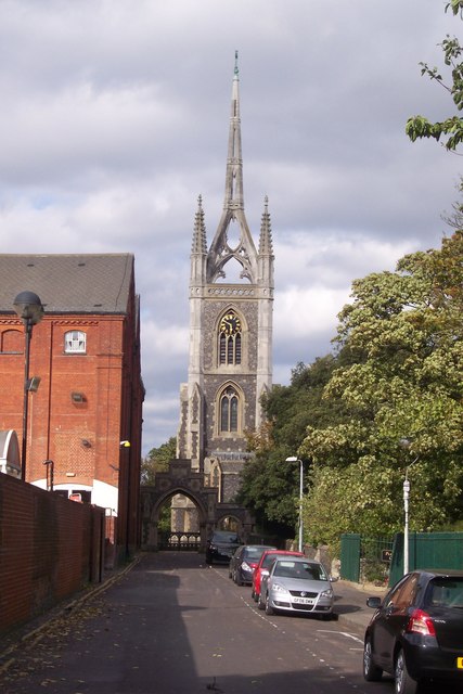
Image: © David Anstiss Taken: 3 Oct 2009
This short road leads from East Street towards St Mary of Charity Church. The large building on the left is part of the converted Fremlins Brewery Building (closed in 1990). The main part of the brewery is now Tesco Supermarket, this was converted in 1996. There is a pedestrian access to the supermarket, further along the road.
Images are licensed for reuse under creativecommons.org/licenses/by-sa/2.0
Image Location
Latitude
51.316194
Longitude
0.893839