Old Jack
Introduction
The photograph on this page of Old Jack by Richard Knights as part of the Geograph project.
The Geograph project started in 2005 with the aim of publishing, organising and preserving representative images for every square kilometre of Great Britain, Ireland and the Isle of Man.

There are currently over 7.5m images from over 14,400 individuals and you can help contribute to the project by visiting https://www.geograph.org.uk
Old Jack
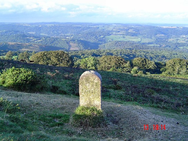
Image: © Richard Knights Taken: 23 Aug 2004
In the 1850s the Duke of Somerset decided to erect a number of named boundary stones along Heytor Down to emphasise the extent of his holding. He intermingled his well rounded stones with a couple of already established boundary stones and natural rocks. All received his initials "DS" together with the date 1853 or 1854. The names of the stones took a decidedly royal approach with "Prince Albert", "Victoria", "Prince of Wales" interspersed with the more obscure names "Wm Stone" and "Old Jack".
Images are licensed for reuse under creativecommons.org/licenses/by-sa/2.0
Image Location
Latitude
50.593125
Longitude
-3.746167