Goathurst Common Well
Introduction
The photograph on this page of Goathurst Common Well by Nikki Mahadevan as part of the Geograph project.
The Geograph project started in 2005 with the aim of publishing, organising and preserving representative images for every square kilometre of Great Britain, Ireland and the Isle of Man.

There are currently over 7.5m images from over 14,400 individuals and you can help contribute to the project by visiting https://www.geograph.org.uk
Goathurst Common Well
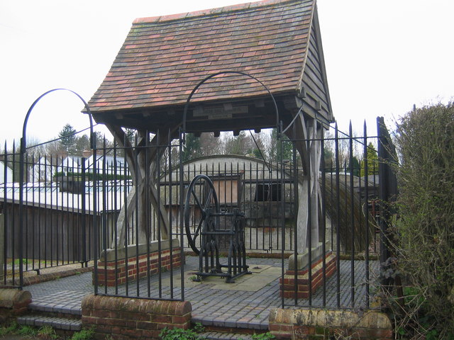
Image: © Nikki Mahadevan Taken: 14 Apr 2006
Prior to the sinking of the well in 1901, villagers used water from rainwater storage tanks. When these ran dry, villagers had to walk down a steep hill to the springs south of Stubbs Woods, to collect their water. Piped water was brought to the area during the 1920s.
Images are licensed for reuse under creativecommons.org/licenses/by-sa/2.0
Image Location
Latitude
51.248457
Longitude
0.142107