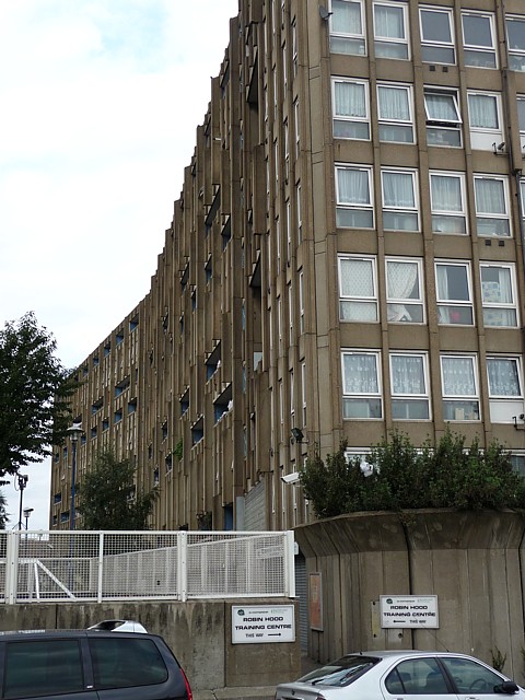
Robin Hood Gardens, Robin Hood Lane (2)
Introduction
The photograph on this page of Robin Hood Gardens, Robin Hood Lane (2) by Stephen Richards as part of the Geograph project.
The Geograph project started in 2005 with the aim of publishing, organising and preserving representative images for every square kilometre of Great Britain, Ireland and the Isle of Man.
There are currently over 7.5m images from over 14,400 individuals and you can help contribute to the project by visiting https://www.geograph.org.uk

Image: © Stephen Richards Taken: Unknown
An oblique view of the west side of the east block. Robin Hood Gardens is one of London's most notorious 1960s housing estates which is deeply hated by some but revered by others as a beacon of modern architecture. There are probably more people in the former camp than the latter. There are two blocks aligned roughly north-south with a patch of green space between them. They were designed by Alison and Peter Smithson in 1966-72, with Christopher Woodward and Ken Baker of the Greater London Council. The buildings embody the Smithsons' idea of "streets in the sky" and are an example of concrete Brutalism, with the pre-cast concrete being rough and shuttered. Pevsner comments that while being "impressively monumental" the scheme is also "inhumane" because of the high density, the narrowness of the decks and its proximity to busy roads on two sides. Tower Hamlets Council plan to demolish the buildings and redevelop the site. A campaign by the Twentieth Century Society and others to halt this by applying for listed building status in 2008 was unsuccessful.

